This site is an outcome of the Comenius 2008-2010 multilateral project "European Journey Through Legends".

"Becoming more European does not mean forgetting our national cultural heritage, but sharing it with other European nation".

Se afișează postările cu eticheta 03.1 The legends of the landforms. Afișați toate postările

The legend of Retezat Mountain

Romanian National Park of Retezat is also known as “the charming land of the blue eyes”. In this natural national reservation, there are over 80 lakes, lakes which could be compared with the eyes of the mountain. So, Retezat Mountain can be considered fascinating massif. Since 1935 it houses a National Park, with a scientific reservation. The Park has recently been listed under the biosphere Reserves, a world patrimony therefore, that calls for adequate protection.

The Retezat Mountains (Romanian: Munţii Retezat) are one of the highest massifs in Romania, being part of the Southern Carpathians.  The massif rises up between two major depressions - Petroşani and Haţeg, and two large rivers - Râul Mare and Jiul de Vest. It is skirted by the Ţarcu, Godeanu and Vâlcan Mountains.

Retezat Mountains

Retezat is probably the most prominent mountain area of the Southern Carpathians (also called sometimes "Transylvanian Alps"), covering almost 500 square km. Its average elevation is over 1500 m, with a quarter of its territory rising above 1800 m (and still rising in our days, by about 3.5 mm/year). The region, made up of mostly granite/grandiorite massifs, was formed by glaciers of the Pleistocene era. These glaciers streched over several kilometers (the longest one, in the Bucura Valley, could have surpassed 15 km). As a result of - in geological terms - recent glacial activity, Retezat is rich in beautiful tarns and waterfalls.

View of the Bucura glacial cirque from Bucura saddle
The main part of the massif, Retezatul Mare, consists mostly of crystalline rocks; the southern part, Retezatul Mic, contains important masses of limestone. The highest peak (2, 509 m) is Peleaga. A huge carp overlooks the Haţeg Depression.

There are two main ridges, approximately SW-NE oriented, joined in their central part. The northern ridge starts from the Gura Apelor Lake and has the Peaks Zlata (2, 142 m), Şesele (2, 278), Judele (2, 334), Bucura (2, 433), Peleaga (2, 509), Păpuşa (2, 508), Mare (2, 463), Lănciţa (2, 066), Brădet (1, 861). The southern ridge, Iorgovanu (2, 014 m) - Piule (2, 080) - Drăcşanu (2, 081) is lower and has the Peaks Custura (2, 457), Gruniu (2, 294), Lazăru (2, 282), Tulişa (1, 792). The most characteristic peak in area, named Retezat like the massif itself, reaches 2, 482 m. The two main ridges extend northwards into some elongated, parallel and fairly long ridges, and shorter extensions southwards.

Due to erosion by frost-cracking, the terrain is almost exclusively rocky in the higher regions.

The widely varied and spectacular landforms are the outcome of the glacial and periglacial modeling cycles: huge cirques, simple or complex; valleys indicating the presence of fairly long glaciers; lakes sheltered in the bosom of rocks; big masses of scree; sharp-edged or residual rocks. The largest and also the deepest glacial lakes in Romania are to be found here: Bucura (~10 ha) and Zănoaga (29 m), respectively. Some of the magnificent waterfalls are Lolaia, Ciumfu, Rovine.

A huge rock dummy on the way - others are much smaller.

On the left (just by the rock doll): Vf. Peleaga (2509 m), on the right Vf. Mare (2463 m). In the middle: lakes of Valea Rea.
Especially the abundant blue and turcoise tarns (situated mostly, but not exclusively, between 1900 m and 2200 m above sea level) give this place a special charm. There are 82 lakes in total, including Romania's largest (in terms of surface area) and deepest glacial lakes: Lacul Bucura /Bucura Lake and Lacul Zănoaga /Zanoaga Lake, respectively.

Lakes and tarns in Retezat Mountains


The lowest and highest lakes of Retezat are "Tăul dintre Brazi"  (1740 m) and Tăul Porţii  (2230 m). Tăul Ţapului  is remarkable because of its small island. In wintertime, all lakes get ice and snow cover, blending totally with the surroundings.

Bucura Lake (area: 8.8 ha, depth 15.7 m, elevation 2041 m)


Zănoaga Lake (1997 m) is the deepest lake of Retezat Mountains.(area 6.5 ha, depth 29m, elevation 1997 m )

The creeks of Retezat have several waterfalls, the two most notable ones being Cascada Ciomfu/  Ciomfu Waterfall in the very upper part of Râu Bărbat (more than 150 m in multiple cascades) and Cascada Lăpuşnicu Mare /Great Lapusnicu Waterfall (about 20 m high, but with ample water flow).

Lolaia waterfall


The Wildlife of National Reservation of Retezat


The flora and fauna of Retezat is very rich. Thankfully, protection of this area is strong, it is a National Park and also a UNESCO MAB reserve. Retezat is home to more than 1100 plant species (including Edelweiss, several species of Gentians, Rhododendron kotschyi, Doronicum carpaticum, Dianthus glacialis, etc.), at least 62 of them being endemic (Rubus retezaticus, Trifolium retezaticum, Festuca pacyphylla, Hieracium borzae and nigrilacus, just to name a few).

The forest covered slopes hide a wealth of fossil screes, while the juniper carpet unfolds on the highest ridges. Several plant species are protected: the yellow poppy, the crosswort, the yellow lily etc.


The flora from Retezat Mountain

Higher crests and sharp ridges are usually barren. The chamois, the mountain cock, the bear and the mountain rat represent the animal world. These mountains are also inhabited by wolves, lynx, bears, otters and marmots (re-introduced in the seventies), several species of birds of prey, reptiles like salamanders and vipers (Vipera berus and Cerastes cornutus  - take care on sun-warmed rocks, especially in Little Retezat). Trouts are common in lakes and creeks. Cows are brought up from the villages to graze in the summer.

Frog
Chamois
Horses


The legend  of Retezat Mountain

Once upon of time  there was a family of giants. When the father died, his two children inherited each a mountain. But the girl was not happy with her mountain and she craved for her brother’s part. He didn’t want to give his sister his inheritance and thus she threw a big rock towards him. He ducked and the rock crushed the top of his mountain. From then the people call this mountain “Retezat”, the mountain without the top. 

Vf. Retezat (2482 m)


Bucura II (in the middle) and Bucura I (right from it) peaks from Pietrele valley.


The legend of Iorgovan 


Iovan Iorgovan is a character in Romanian mythology, similar in some ways with Hercules (some writers consider him to be the same person).

"It happened in those old times, when multiple-headed, fire-breathing dragons were the lords above the rocks, that Iorgovan, a strong young man was in love with a beautiful sheperd girl. One day, the girl didn't come back from the mountains. Iorgovan went to look for her, but his long and desperate search was in vain. Being saddened by the big loss, he decided not to return to his home in Wallachia, but to live in reclusion at the rock which is named after him today.

Iorgovan had been living like that for a while, when one day a beautiful female voice echoed from the distance. He immediately reckognised the voice of his lost love, who was kidnapped by a dragon. Iorgovan knew that he was thought to be dead at home, so he headed down to the other side of the mountains, to Transylvania, where he acquired a huge, 40-centner maul. Next time when the dragon was enjoying the sun on a nearby rock, Iorgovan took a horse to hop over the other rock and battled him, but the dragon was stronger.

Iorgovan survived, but was very upset about the defeat. So, he went down to Transylvania again, and this time he got an even bigger, 99-centner maul. With this he battled the dragon once again, and won after a long fight. The dragon breathed fire in his anger, turning all the trees and bushes in his way into ash. Iorgovan chased him all the way until the border. Here the dragon turned to him and said: "Well, Iorgovan, until now I was the lord of the mountains and all the animals who live there... from now on, you will be, but I'll send deadly flies to take a revenge on you and your herd".

The dragon left towards the mountains of Mehadia, and bled to death in one of its caves. His fire heated up the springs so much that flies still keep on coming and continuously pestering poor cattle in the mountains since then. And the horseshoe imprint of Iorgovan's horse can still be seen on the top of Iorgovan's rock..." (https://www.summitpost.org/retezat-mountains/265121)

The Legend of Scărișoara Cave

Have you ever imagined spending the summer in a place that’s got it all? Beautiful sea, amazing blue lagoons, challenging peaks, fairy woods, mystic hills, snow under the hot summer sun and so many hidden wonders you can’t even count? Well, Romania is such a place.


Scarisoara Cave - Apuseni Monuntains

http://www.itim-cj.ro/Esir/ESIR%20field%20trip.pdf


There is no place in Romania that doesn’t hold a gem waiting to be discovered and yet we know so little about these wonders. Some things can’t be described in words and the writer needs real images to help her expose the beauties that stole her heart so long ago.  Each place has a legend, something from illo tempore that breathes to the present and makes the traveler step carefully on each path.


Did you know that the Carpathians hold the largest ice cave in Southeastern Europe and the second largest in the world after the Eisriesenwelt Ice Caves in Austria? This cave is on Romanian territory, in the county of Bihor, part of the mountain chain in Carpathians called the Apuseni Mountains. Situated in the Apuseni Mountains almost 40 km away from the town of Campeni, in the North-Western part of the district of Alba, in the commune of Garda de Sus, Scarisoara Cave is one of the largest ice caves in Romania (it holds the world’s second largest glacier; the largest in the world is  Dobsina ice cave, in Slovakia, depending on the source ) .
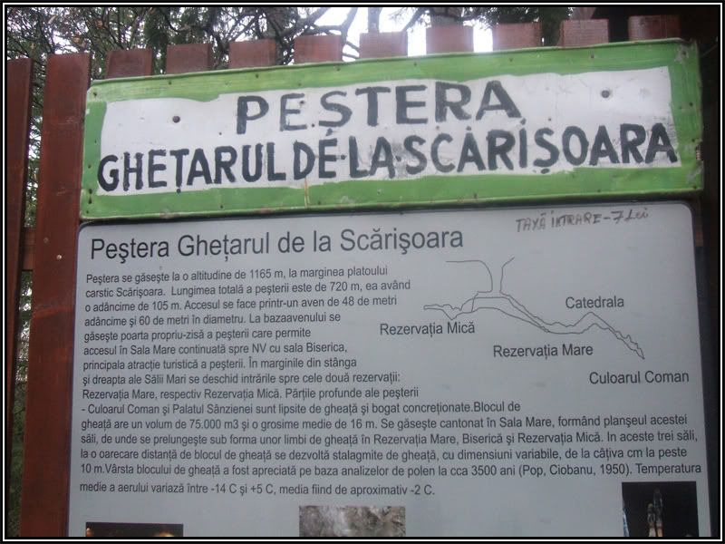
One cannot say precisely the date when the cave was discovered, but it is mentioned in 1863 by Adolt Schmididi, an Austrian geographer who made the first observations regarding the cave and also its first map. Declared a natural monument and a speleological reservation, the cave (situated at 1150 m altitude) is famous for its glacier that is older than 3000 years. The area of the glacier is 5500 square m and the ice layer alternates between 26 and 37 m in thickness.

Scarisoara Cave is 750 m long, but only 250 m of it may be visited. It’s 110 m deep, the entrance shaft is 50 m in diameter and 48 in depth and the access for tourists is done through a metallic ladder.

While in the cave you’ll probably encounter bats and some small ice beetles called Pholeuon prozerpinae glaciale. Although a Rupicapra skeleton was discovered in the ice, there are low chances that you will encounter other animals in the cave.


Cave description
Ocoale – Coteţul Dobreştilor karst system
(after RUSU et. al., 1970).


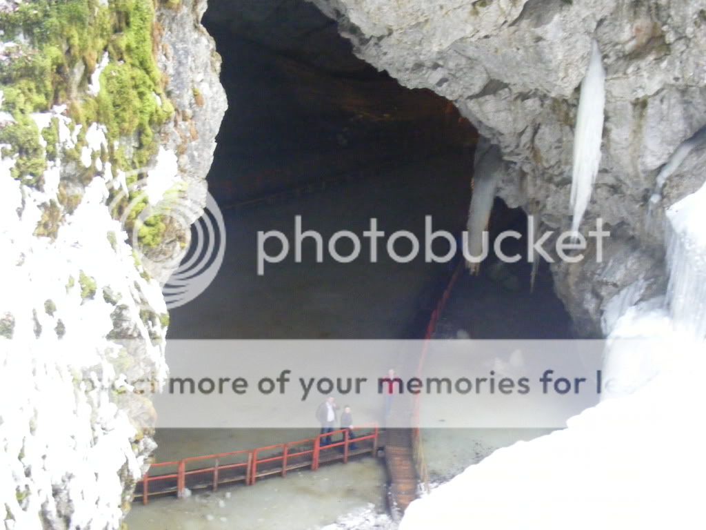
The Scărişoara Glacier Cave (Fig. A, B) opens with an elliptical, funnel shaped shaft of impressive dimensions: up to 60 m in diameter and 48 m in depth.


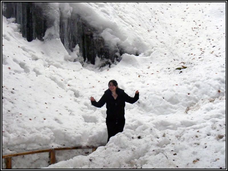
The bottom of the shaft is covered with a thick layer of snow, which does not melt even in the hottest summers.


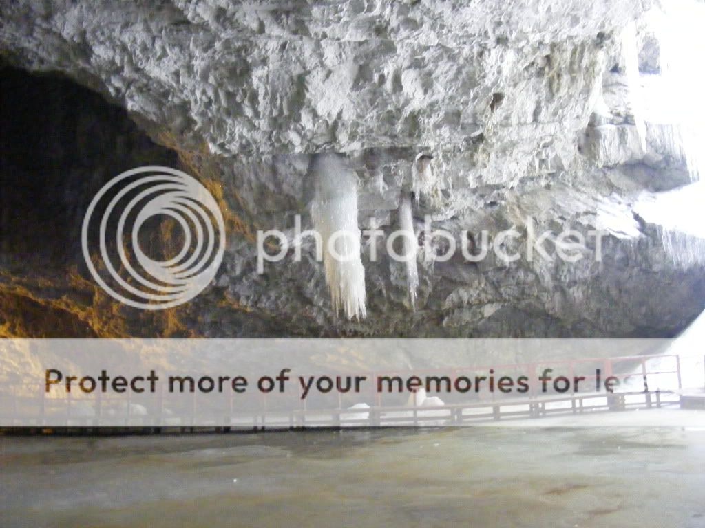
“Zool of ice (Foca de gheata)” is right at the entrance – Scarisoara Cave.


The cave has many sectors that have different names. Thus, right after the entrance one may see the Big Hall and afterwards The Church where there are more than 100 ice stalagmites, The Church being in fact the main touristic attraction. To the left of this hall, walking through a 70 m long gallery, one can reach both The Great Reservation and The Small Reservation. Visiting these sections is allowed only for scientific goals and with the agreement of the Speological Institute “Emil Racovita” in Cluj. The Gallery Maxim Pop lies at 105 m underground, which is the maximum depth of the cave. The other two sections of the cave are The Cathedral and Sanziana’s Palace, but they don’t contain ice.


The cave was believed to develop in massive reef limestone of Ladinian (Middle Triassic) age. The authors estimated the age of the limestone by using paleontological and structural elements. BUCUR & ONAC (2000) have recently sampled the limestone in different point of the cave and studied by means of microfacies. The association is characteristic for the Upper Jurassic, most probably Lower Tithonic.

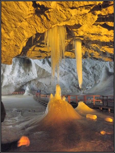
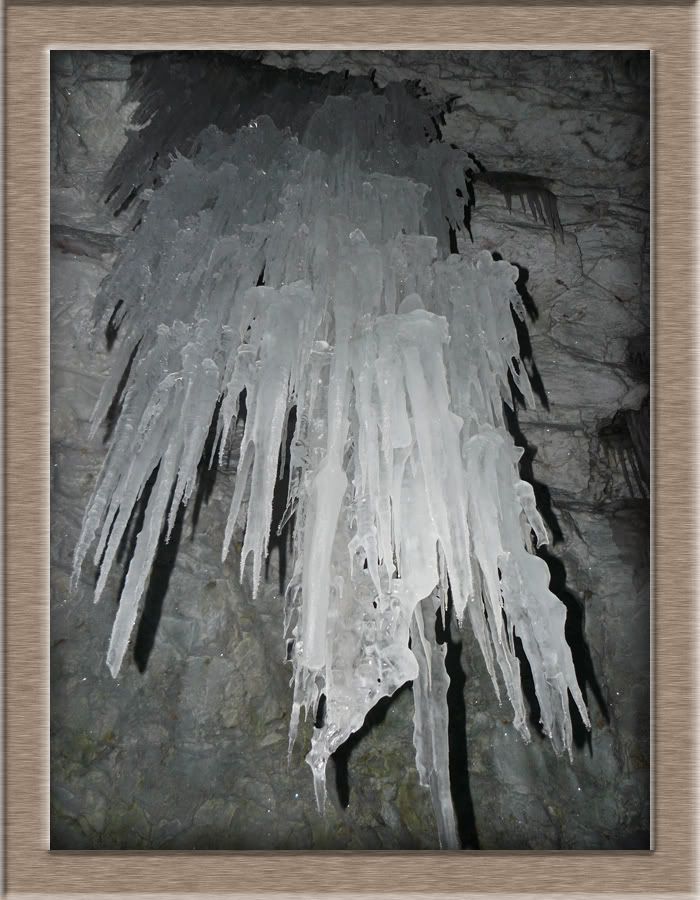
The cave entrance is located in the western wall of the shaft and has an imposing arch 24 m high and 17 m wide. Beyond is the “Sala Mare’s” (Big Room’s) ice floor, a 3,000 m2 perfectly horizontal surface, with just four massive conic ice formations. One is on the left side and the other three are attached to each other near the wall opposite to the cave entrance. Usually, these form large ice columns. During springtime, ice stalactites form on the room’s ceiling, but their existence is ephemeral. To the north, there is a second opening towards the surface Towards the NW, the horizontal floor ends with a steep slope dipping 8 m that can be descended by steps carved into the ice leading into a second room. Local residents have named this area “Biserica” (The Church). Here, ice speleothems dominate the underground scenery.

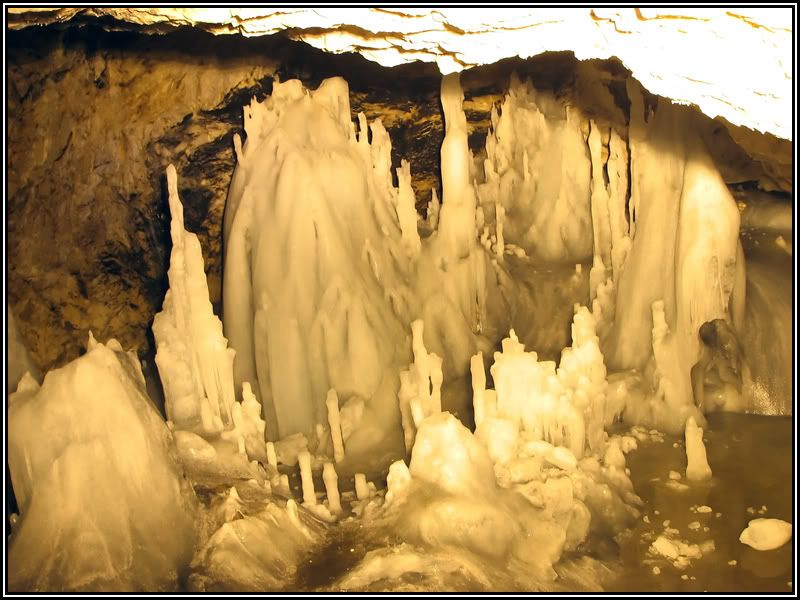
On sunny days, the tips of the stalagmites shine in the reflected light from the snow accumulated at the bottom of the shaft, creating the impression of gigantic lighted candles. The “Biserica” continues with a narrow side passage lacking ice formations. At its end is a succession of three small circular-shaped cavities with walls bearing traces of water flow.

Another ice slope can be descended on the left side of the Sala Mare before entering the “Biserica”. At its base, a narrow space between the glacier and the cave’s limestone wall (crevice) formed due to wall’s higher temperature. The shaft, the Sala Mare, and the “Biserica“ are parts of the tourist section of the cave and are toured without caving gear. On the other two sides of the Sala Mare, the space between the ice and the limestone walls allows access into the deep parts of the cave that have been declared scientific reserves. Visiting these areas requires a minimum of underground climbing experience, as both passages are either vertical or almost vertical cliffs.

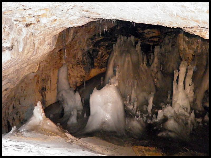
The Rezervaţia Mică (Small Reserve) is on the northern side of the Sala Mare and can be entered by descending a 15 m vertical cliff (Fig. 5A), along which the ice stratification is visible. Two other crevices form at the side edges of the ice cliff near the limestone walls, which both descend steeply and almost reach the base of the ice block. In the central part of the room, not far from the ice block, a field of ice stalagmites forms. They differ from the ice stalagmites found in the “Biserica” in that they do not appear as massifs but as isolated stalagmites. Beyond these, the cave floor is partly covered by a calcite crust and rises abruptly towardsa short passage called “Palatul Sânzienelor” (Sânziana’s Palace) in which there are only calcite speleothems. There  are still two unexplored chimneys at its end, which could be very important in the depicting the genesis of the Scărişoara  Glacier Cave.

The entrance to the Rezervaţia Mare (Big Reserve) is much larger than the previous one and is located on the southern side of the Sala Mare. Within this part of the cave, the largest rooms are found (20 to 45 m wide and up to 20 m high). Here the ice forms a steep slope to a depth of 90 m below the surface. This passage was named Galeria “Maxim Pop” (the Maxim Pop Passage) in the memory of the leader of the 1947 expedition. On the horizontal bedrock floor in the central part of the Rezervaţia Mare is another field of ice stalagmites similar to the ones in the Rezervaţia Mică. Beyond this area, the cave floor rises abruptly and is covered by huge collapsed limestone blocks. On top of these, large calcite domes have formed.

Thus, this part of the Rezervaţia Mare is called “Catedrala” (The Cathedral). At the end of "Catedrala", a narrow passage opens through agrate of stalagmites and enters the Coman Passage. Besides being well decorated, this passage reaches the cave's maximum depth of -105 m (RACOVIŢĂ & ONAC, 2000).

Based on topographic surveys performed on 1965, the total length of the Scărişoara Glacier Cave is 700 m.


Climate


From a climatic point of view, the cave has a complex structure, with four meroclimatic zones (RACOVIŢĂ, 1984): a transition meroclimate in the entrance shaft, a glacial zone in the vicinity of the ice block, a periglacial one at certain distances from the block, and a warm meroclimate in the non-glaciated parts of the cave. The repartition of these meroclimates is reflected by the thermal pattern of the cave: while in Great Hall the mean annual temperature is around –0.9ºC, it increases to –0.2ºC in the Great Reservation and 4.3ºC in the Coman passage.


Snow in may at the Scarisoara Cave entrance


Air circulation is one of the most important factors for ice dynamics in the cave (Fig. 6). We can distinguish between two seasonal types of circulation: summer and winter, respectively.


During winter, airflow, triggered by the high density of external cold air, is directed from the surface downward into the cave. The cold airflow first reaches the Big Hall, from which it descends into both the Little and the Great Reservation. The cold air replaces the warm air from the cave; the warm air rises is “pushed out” along the ceiling of the cave. This type of circulation (lasting for approximately 5 months between November and April (RACOVIŢĂ & ONAC, 2000), transports large quantities of cold and dry air in the cave, leading to a diminution of humidity (less than 80%).

Since the cold air in the cave is denser than the external air in the summer, there is no air mass exchange between the cave and the outside (equilibrium occurs between the outside air and inside air of the cave). Differences in temperature (and thus the air density) between various parts of the cave cause two convective cells between the Big Hall and the two reservations. Cold air maintained by the overcooled walls and the ice block, flows down into the reservations replacing the warm air. This warmer air rises and follows the ceiling of the cave, but as it reaches the Big Hall’s walls it cools down, thus maintaining the convection.

This type of circulation is occurs from May until October. In April and October, rapid changes between summer and winter types of circulation occur, as temperature varies around 0ºC. Due to the ventilation system, the Scărişoara Ice Cave is subdivided in three distinct parts, called meroclimatic sectors. These sectors are differentiated through the physical (air) parameters and the types of speleothems that develop in each of them. The glacial sector covers the Great Hall, where external influences are the most intense and the ice forms a compact block; the periglacial sector covers the three halls surrounding the ice block, where external influences are reduced and ice stalagmites develop; the warm sector characterizes the farthest parts of the cave, where external influences are practically eliminated and the speleothems are exclusively calcitic.


The ice speleothems


The ice block formed by the freezing of the water that was supplied from two sources. The first source is the rainwater that infiltrated through surface fissures in the limestone or through the chimney located close to the entrance in the Church. The second source is partial thawing of the snow accumulating at the entrance shaft bottom and that of the surface ice layer from the Great Hall floor.


The ice block consists of 0.5 to 15 cm thick sandwiched ice layers and mineral and organic impurity layers, usually thinner, of only 2 – 7 mm. The organic layers form during the summer when the temperature of the underground atmosphere increases slightly above zero. Consequently the level floor of the Great Hall is covered by a water film approximately several centimeters thick, but deeper in front of the portal. Limestone dust formed from the weathering of the wall due to alternative freezing-thawing is deposited at the base of this film of water. The soil and plant remains are brought in by water flowing down the shaft walls. The water film freezes in the following winter, forming a new ice layer which ultimately encloses all sediments.Therefore, the elemen tary stratigraphic unit corresponding to one year in the primary structure of the ice block is represented by an ice layer and an impurity layer. The ice stalagmites are formed by a mechanism similar to the one of calcitic speleothems, the difference being that the seeping water freezes instead of depositing calcium carbonate. Both speleothem growth and their overall morphology are controlled by air temperature and drip frequency. The amount of ice deposited on stalagmite tips depends on how fast the water freezes. When this process is fast, water drops freeze almost instantly, causing an increase in height. When the process is slow, water drops first ooze down the sides of the stalagmite, contributing mainly to an increase in thickness. This also explains why most ice stalagmites have the upper part expanded in the shape of a warclub.


The ice stalagmites are made up of hexagonal ice crystals whose growth is governed by the law of geometric selection. According to this law, the only crystals that develop unrestrained are those growing perpendicular to the column axis or disposed radial around the stalagmite tip. In the stalagmite mass, crystals form concentric layers of several centimeters thick, but it is not yet known how such layering is initiated. The main factor in the dynamics of ice speleothemes (i.e. ice stalagmites) in Scărişoara Ice Cave is the dripping water which, depending on temperature, can act as a favorable element for both the growing and melting of ice (PERŞOIU, 2004). Between January and April these speleothemes had a growing phase, more important in March and April, while between April and December they went through a melting phase. The ice block has a more complex dynamics, being influenced by both external and internal factors.


Dripping waters and heat transfer through conduction in summer determines the melting of ice at the surface of the ice block and development of a shallow lake (up to 20 cm in depth). In addition, the warm water of this lake (directly heated by sunshine) contributes to the general melting of the ice block, both on the top and on the sides. Cold air, with water vapor content frequently below 90 %, enters the cave in the winter months leading to rapid ablation of the surface of the ice block. The geothermal heat flux melts the base of the ice block, leading to the development of sub-glacial tunnels. Later these tunnels are enlarged through sublimation processes by the same cold and dry air circulating under the ice block. This cold air is also responsible for the onset of ice development in late autumn (October-November). During this period, the rapid infiltration of cold air regulates the freezing of the water on top of the ice block and thus its thickness. Scărişoara Ice Cave stands out among the other great ice caves in the world due to the fact that it hosts not only varied ice speleothems in a relatively restricted space, butalso a large selection of calcite speleothems. Concentrated mostly in the Cathedral and in the Coman Passage, these speleothems are represented by stalactites, stalagmites, columns, domes, draperies, clusterites, flowstones, and gours, to which are added the bizarre cave pearls.


How come the ice never melts?


Scarisoara Cave was formed during The Ice Age when the mountains in which it is nowadays situated were covered with snow and ice. The cave has only one opening in the upper part and so the air currents are formed that keep the ice still solid.


In winter, the air temperature in the cave oscillates the same way it does at its entrance; in summer, the temperature reaches up to 1 Celsius degree and that’s why an ice layer in the floor of the Big Hall is melted, but only a few cm.

The access for tourists is done through a metallic ladder.


Legend of Scărișoara Cave


The old stories tell that in the cave a dragon used to live in ancient times, which the inhabitants used to call Solomat. The dragon used to steal a beautiful girl, either in the New Years’ Eve or in the night before Girls’ Fare at Gaina and he used to hide them in an ice palace that was never seen by the inhabitants.

Another legend says that, there used to be two water basins that were full of water all the time. They were situated behind the lime formation called nowadays “La Brazi”. It is said that the person that kneeled before the basins, uncovered his/her face, drank the water and made a wish, that wish would come true. The only condition for that to happen was that he/she had the obligation not to tell anyone the wish he/she made.


Quick Quiz

 Answer following questions and send me answers via Geocaching profile:

a) How old is the glacier ?

b) What is the depth of the cave ?

c) At what height is the cave ?

d) What is the inside temperature ?

e) In what period glacier formed ?

f) How come the ice never melts?

The Legend of Mount Găina

The Legend of Mount Găina

Once upon a time there lived a beautiful and rich fairy at the edge. She had a hen which laid miraculous golden eggs every day. The fairy  ortioned once in a year a golden egg to a poor and honest girl when she married. One day five young boys from Vidra, dressing women attire, edged out to Fairy of the mountain and stole the hen and a pannier full of golden eggs. They ran and one of them let fall rolling to insurgent waters of Aries. They hid the hen then in Abrud Mountains where is a big fortune. Angrily, the Fairy of golden baths fell away from those emperies.


Since then, the young people (girls and boys) knew to climb on the crest of Mount Găina (1486 m) in the third Sunday of July and they hope they maybe will meet her one day. This their meeting became Mount Gaina Maiden Fair - In the Sunset Mountains (Apuseni Mountains).


Voices of Angels Resounding from Tulnic Tunes


http://www.rounite.com/2008/07/16/bucium/


In Romania, the sound of an angel’s song is absolutely unique, something you will never ever hear some place else. That’s because angels use the tulnic or bucium to deliver their musical messages.


The term “bucium”, derived from the Latin word “bucinum” (meaning curved horn or trumpet blast) is used n the Muntenian Carpathians of Arges and Prahova, and in the Moldavian Carpathians of Vrancea and Neamt. In Romania’s northern regions the name might be linked to the Slavic “trambica”, and may have been taken over from the Huţul populations. Other names of the same instrument are “trambita” in Bucovina and “trambita” or “tranghita” in Oas and Maramures.

The tulnic is an instrument with origins lost in our Dacian roots, somewhere at the dawn of civilization. It resembles the Alpenhorn but the sounds of the two instruments are quite different. Their usage however is sometimes similar. Specific to mountain dwellers in particular, it is mostly used by shepherds for signaling and communication in the forested mountains, as well as for guiding sheep and dogs, and it also used to be way to signal military conflicts in the principalities of Moldavia and Wallachia. Although it’s a huge instrument, ranging from 1.5 to 3 meters, women in the Apuseni mountains are using it frequently, sometimes to call their loved ones, other times for more practical purposes.
Tulnicărese

The alpenhorn is a big tube, opened at both ends and composed of long staves of fir, ash, lime or nut tree wood, very well dry. These stoves are tightened with wooden or metal circles. Of Roman origins, the alpenhorn is used by the mountain shepherds for signaling different things. In the Apuseni Mountain the alpenhorn is called "tulnic". In some regions it is played on the funerals. In the past the alpenhorn was used for signaling the Turkish invasions.


Depending on the region of the country, communications through the bucium song happen in different times of the day and have different meaning. While the shepherds are those who mostly use it (in the evening to call their sheep and dogs, or in the morning to take the sheep out), it is also an instrument leading funeral processions in Oas, Maramures and other villages in the north of Neamt. In the Apuseni, where women are the patrons of the tulnic, it’s mainly a communication device for those living in the highlands, similar to how Scandinavians use their luur.

The tube is made of well-seasoned deal, maple, ash, lime or hazel wood which is conical or cylindrical bored, slit length ways, hollowed out and then glued together. In northern Romania, metals are added to the tube: it can be made of galvanized iron and folded like a trombone. As it does not have valves or finger holes it can only play the pitches in the natural harmonic series.


The sounds of this instrument still seem to me the best to express lost love, missing the one you’ve lost or who is far away. When those women started singing, everything else just stopped, no one could think of anything else, except the song and the eyes of the musicians. There was a special glow, one seeming to hide secrets from long ago. No doubt angels chose this instrument to announce the Judgment Day!


Romanian Traditions - Mount Gaina Maidens Fair


One of the Romanian traditions that survived to this times, the "Maiden Fair" is an incredibly enjoyable day for the people living in that region to gather on the mountain top of the Mount Gaina. Each year, from times immemorial, people would gather on the mountain top of the Mount Găina for this so called Maiden Fair. Despite it is called maiden fair, nobody sells or buys girls on this event, and perhaps such trade never happened. Nevertheless, it is a big celebration of all the mountain-dwellers, gathering from far distances to one particular spot in the mountains, to meet each others, exchange ideas and traditions, sing, dance, enjoy themselves, celebrating being alive. There were plenty of situation in which young boys would meet young girls from different, far away villages, and end up getting married, but the main purpose of this event seems to be the social interaction of young people all around the Western Mountains.


The idea of this also called festival was given by the fact that the villages there are scattered at large distances from each other, with some kilometers from house to house, so it was quite hard for people to meet. Life and climate can also be quite harsh, so they really needed a special occasion to be able to reach each other. So, the Maiden Fair's purpose was and still is keeping people in touch.

This festival is probably the largest of its kind in Ardeal. It is held on the mountain of Gaina ("hen" in Romanian). Obviously, the festival has lots this tradition, the name (The Girls Market from Gaina) being the only way to keep it. Nowadays , the Gaina festival is about concerts, enjoying the beautiful nature of the region and it's very friendly people, this celebration is actually a pretext for going out, savoring delicous traditional food, socializing and buying trinkets.

Women playing the alpenhorn, renown all over Europe, launch the call to open the festival every year. This festival is an event that gathers craftsmen, traditional costumes, traditional dances and songs.

The myth of the creation of mountains and of the forests

After God created the Sun, the Moon, the Earth and the Stars, He threw all in the womb in order to get never together. He got off only some ogres – bad and lazy creatures. The ogres wanted to create something to exalt them to be superior to God. They’ve started to hoe and truck mould succeeding to create the mountains. They wanted to create the mountains in order to take over the sky. God found out and drew them down on the level of the mountains and laid on the grove under mould clamp, mould they have created the mountain. And to be sure that they will never get out from there, God got lookers all over the mountain, and they were turned into forests by a rogue hand.